Birmingham City Council
Tree preservation zone
There is a problem
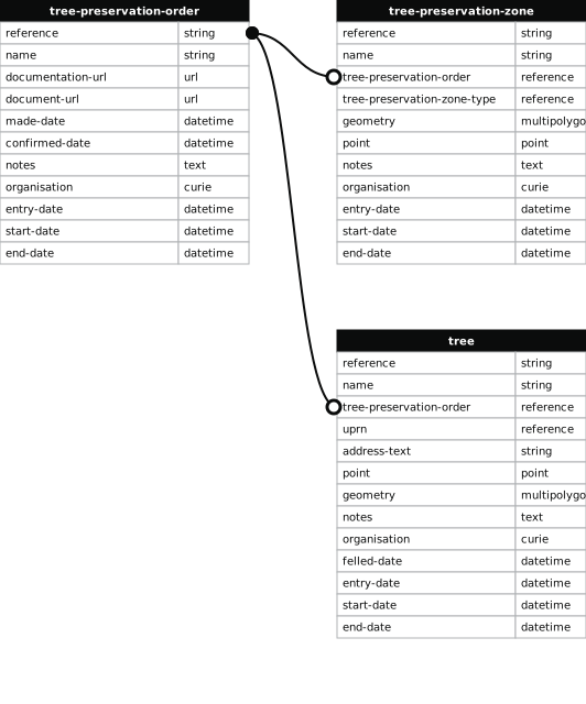
- 1000 entries with tree-preservation-order field must match the reference field in the tree preservation order dataset
THE BIRMINGHAM (LAND FRONTING ASH TREE ROAD/PERSHORE ROAD/CHARLOTTE ROAD, STIRCHLEY) TPO 1983
- reference
- 418
- name
- THE BIRMINGHAM (LAND FRONTING ASH TREE ROAD/PERSHORE ROAD/CHARLOTTE ROAD, STIRCHLEY) TPO 1983
- tree-preservation-order
- TPO 418
- tree-preservation-zone-type
- area
- geometry
- MULTIPOLYGON (((-1.923304 52.422516,-1.921898 52.422640,-1.921976 52.422971,-1.921486 52.423017,-1.921591 52.423489,-1.921593 52.423492,-1.921597 52.423494,-1.921614 52.423497,-1.922311 52.423433,-1.922894 52.423383,-1.923163 52.423363,-1.923365 52.424087,-1.924656 52.423817,-1.924656 52.423813,-1.924888 52.423748,-1.923757 52.422938,-1.923304 52.422516)))
- point
- POINT (-1.923131 52.423243)
- notes
- The shaded area represents those properties which fall within the outline of a Tree Preservation Order. To precisely identify trees protected by the Order, you can request a copy of the tree preservation order at the following link.
- entry-date
- 2026-10-15
- start-date
- end-date
How to fix this issue
Your data is missing a tree-preservation-order.
The tree preservation zone guidance explains how to fix the issue:
tree-preservation-order
The reference for the tree preservation order that covers this zone.
How to improve Birmingham City Council’s data
- Fix the errors indicated
- Use the check service to make sure the data meets the standard
- Publish the updated data on the endpoint URL